 Weather and power permitting, this laboratory will explore latitude and longitude.
The laboratory will also look for a relationship between distance in minutes along line of latitude and distance in meters.
Weather and power permitting, this laboratory will explore latitude and longitude.
The laboratory will also look for a relationship between distance in minutes along line of latitude and distance in meters.
Weather and power permitting, this laboratory will explore latitude and longitude.
The laboratory will also look for a relationship between distance in minutes along line of latitude and distance in meters.
In part one we will work outside. While outside we will use global positioning satellite (GPS) receivers to walk along a line of latitude. Lines of latitude run east - west. We will walk along a line latitude heading due west. The start and end longitude will be recorded using a GPS unit. We will also use the GPS to keep track of the number of meters we walk. A Rolatape surveyor's wheel will be used to provide a second measure of the distance in meters. If we have more than one GPS, then we will use the extra GPS units to provide additional distance in meter measurements.
Use the following tables to gather data. There may be changes in the equipment used on the day of the laboratory.
| Line of latitude walked | Starting longitude | Ending longitude | Difference in minutes along the line of latitude |
|---|---|---|---|
| Instrument | Distance/meters |
|---|---|
| Bushnell Onix 200 | |
| Garmin eTrex 1 | |
| Garmin eTrex 2 | |
| Garmin eTrex 3 | |
| Rolatape 300 surveyors wheel | |
| Google Earth ruler (part two) | |
| Mean distance in meters: |
In part two, power and Internet permitting, we will learn to use Google Earth to measure the same distance we walked. Google Earth has a ruler feature that can measure in meters.
When you first open Google Earth on Linux there is are display problems in Google Earth version 4.2.205.5730 on the Ubuntu 7.10 Gutsy Gibbon operating system on the math science computer laboratory computers spring 2008. The problem is with Google Earth and not the computers. The instructor will have to demonstrate how to work around the display glitches which cause Google Earth to incorrectly layer dialog boxes such as the ruler on the Google Earth main viewport window.
Choose the Options item on the Tools menu.
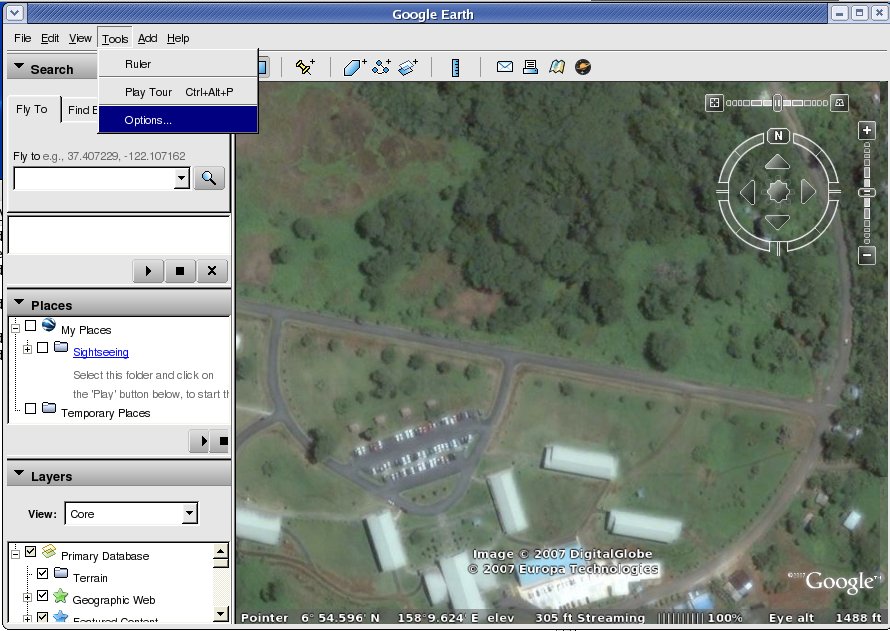
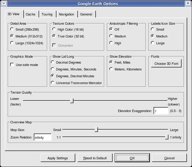
On the Options menu, in the Show Lat/Long section, click on the radio button to select Degrees, Decimal minutes. This will display latitude and longitude in decimal minutes in Google Earth, which will concur with the set up of the GPS units.
![]()
![]()
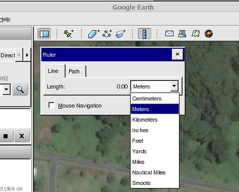
Above the image seen in Google Earth is a blue ruler button, seen above on the right. Click on the ruler button. In the ruler dialog box changes the units to meters. Uncheck the Mouse Navigation box to make it easier to position your ruler.
In order to use the ruler, your instructor will show you how to drag the "invisible" ruler dialog box off the Google Earth screen. The layout that works best is seen below.

Note that the layout seen below is not possible spring 2008 due to the display issues for Google Earth on Ubuntu 7.10 and Ubuntu 8.04 alpha 5. DO NOT MAXIMIZE Google Earth - the program will quit abruptly (crash)
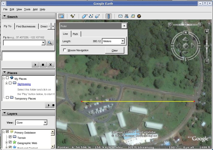
Drag the ruler from the start latitude/longitude along a line of longitude to the end longitude based on the data from the GPS units. Write down the distance in meters from the ruler.
Divide the mean distance in meters by the difference in minutes. How many meters per minute?
There are 1000 meters in a kilometer and 60 minutes in one degree, how many kilometers per degree at our latitude?
There are 360 degrees in a circle, What is the distance around the Earth at our latitude?
Discuss the mathematical relationship between minutes and meters along a line of latitude. Think carefully about whether this relationship would be the same along other lines of latitude such as the equator, 45° North, and 90° North (at the north pole). Discuss which way on campus lines of latitude run. Discuss which direction lines of longitude run on the campus. Which way is North on campus?
Also marked: [f] [GVOC]